Since many of the battles listed above are shown in pictures on the prior pages, here I mostly include photos that are more documentary as opposed to picturesque. Pictures rarely convey much about battlefields and wat happened there, so consider this as a guide written for others considering visiting these places. I found some other sites with similar guides but not the level of detail I wanted. For maps of battles, Wikipedia typically includes some good maps, and more are available on Google.
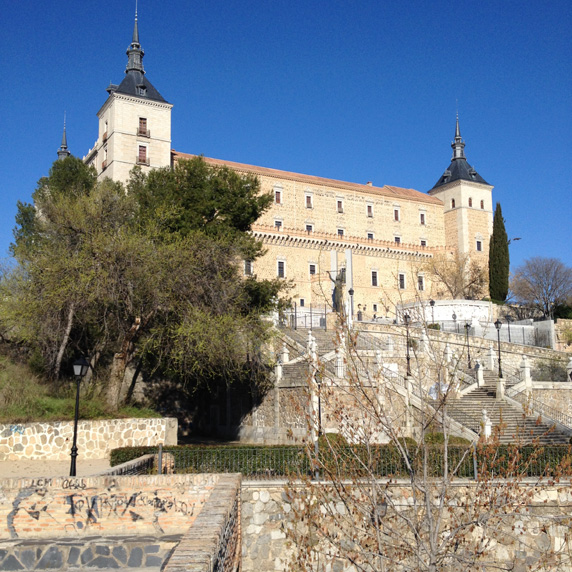
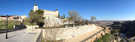
The area right around the Alcazar has plenty of bullet holes and pockmarks left over from the Spanish Civil War and the famous seige that took place there.
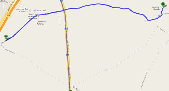
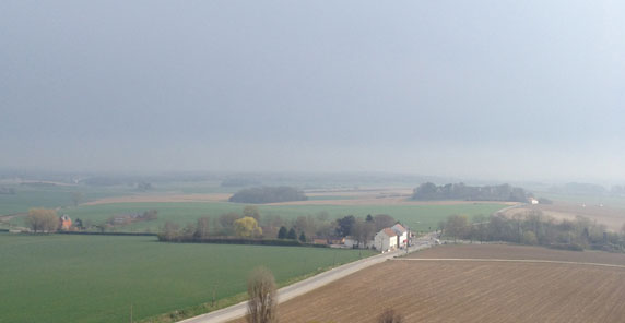
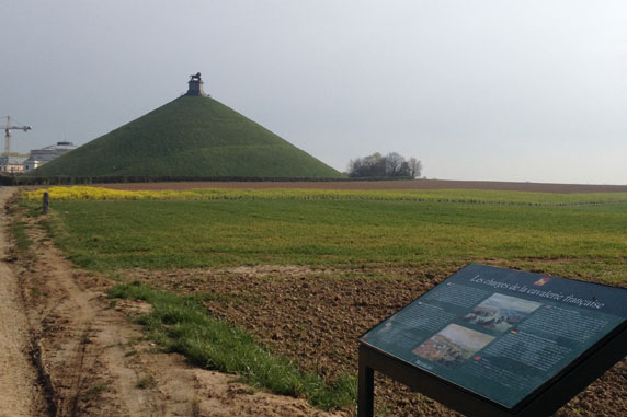
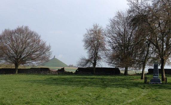
This is one of the best-marked battlefields I've visited, with a new museum under construction on-site and a huge diarama, as well as the tall Lion Mound with its great vista of the whole field. Hougoumont Farm was under renovation in preparation for the anniversary. I also found it interesting to drive to the eastern edge of the battlefield, which also saw heavy fighting, and where some of the old houses still exist and today are stud farms.
Napoleon's last HQ.
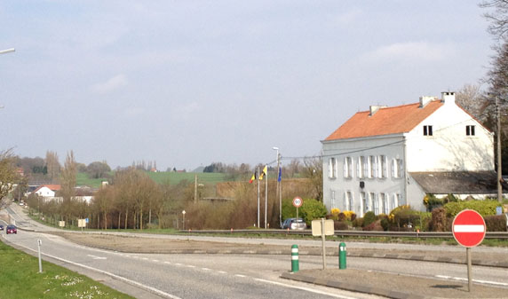
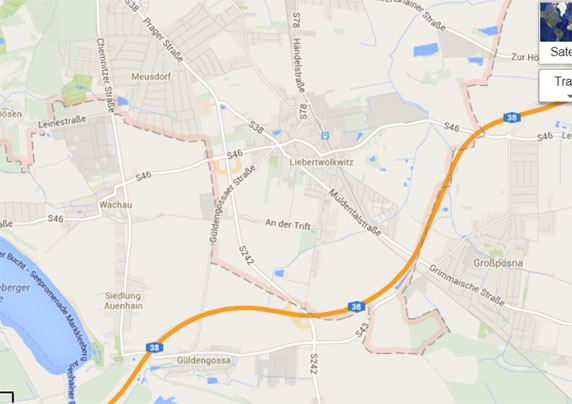
Aside from the gigantic monument to the Battle of Nations (pictured on the prior page of this gallery), there is depressingly little to see at this gigantic battlefield. The city of Leipzigs old quarter has few traces of the walled city, and the course of the river Elster has been changed since the days when the retreating French mistakenly blew the bridge providing their only retreat. Napoleon spent the night in a tavern in the old town, but I'm not sure if the location is known, and anyway its likely gone now. The best battlefield views are along the little roads connecting Probstheida, Liebertwolkwitz, and Wachau. There are a couple small monuments (one to Schwarzenburg on Probstheida) and obelisks amid the fields southeast of Leibertwolkwitz. In these fields took place some of the cavalry charges of the battle. The fields are flat so there is not much terrain to admire.
Battlefield just east of Leibertwolkwitz, looking toward the town.
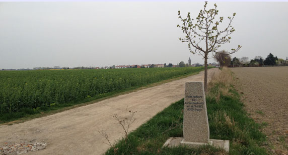
Battlefield marker looking north, located just east of Leibertwolkwitz.
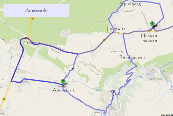
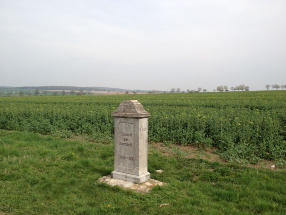
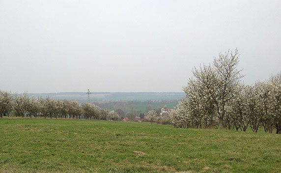
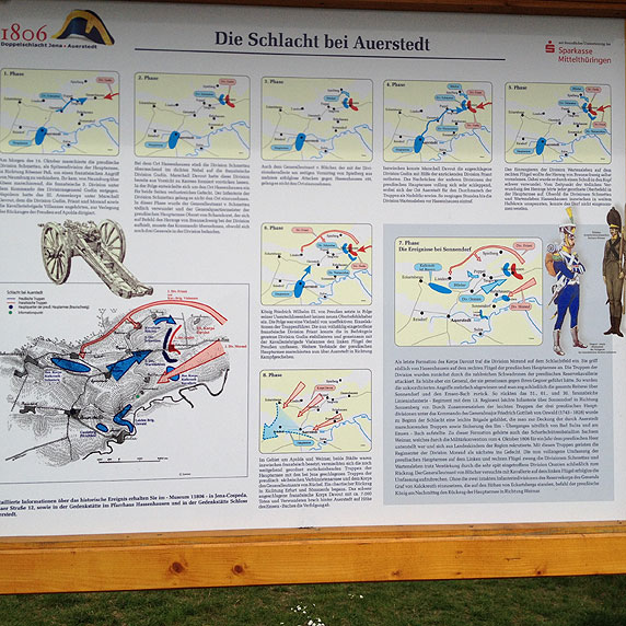
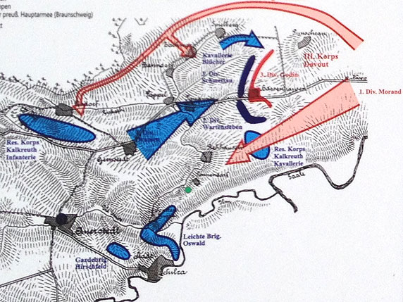
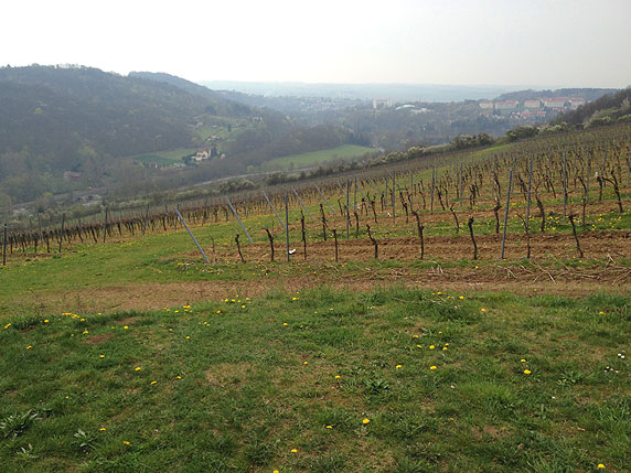
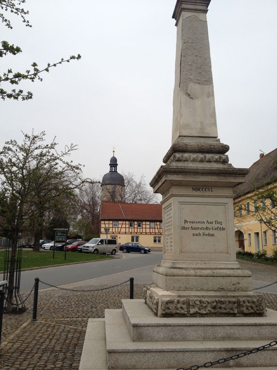
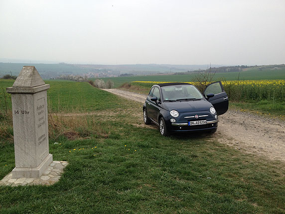
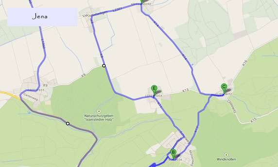
I approached the Auerstedt battlefield from the direction of Naumburg. At Hassenhausen, I turned north along the Spielberger Weg, to Spielberg, then down to Taugwitz, and south to the ridgeline around Rehehausen. There are a few obelisks marking the major positions of the armies, as well as a nice explanatory sign and map near Rehehausen. From there I drove down into the valley of Bad Sulza and back uphill to Auerstedt, where there is a small museum as well as a monument to the Franco-Prussian Battle of Sedan. From there I drove back to Hassenhausen to admire the monument to the Duke of Brunswick, passing a couple more obelisks on the way uphill towards Gernstedt. Then I headed through Eckartsberga, where I missed the chance to explore the castle. Overall, this battlefield is quite picturesque and hilly, with lots of dramatic vistas, though I dont believe there is any one position that gives a complete overview.
Marker indicating location of initial lines between Hassenhausen and Spielberg, located on the road connecting the two villages.
Looking northeast from the heights above Rehehausen to the area of initial fighting, taken from near the narrative sign on the road from Taugwitz to Rehehausen.
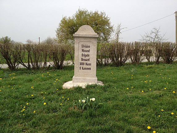
Marker of where the French brigade under Morand moved advanced on the French right.
Explanatory sign near Rehehausen
Detailed map of the action near Rehehausen
View town the valley from Rehehausen towards Auerstedt.
Marker in Auerstedt commemorating the Battle of Sedan as revenge for Jena and Auerstedt.
Marker for Prussian lines just north of Auerstedt.
Marker for Prussian lines just north of Auerstedt, looking towards the east where the French advanced.
Obelisk for the mortal wound of the Duke of Brunswick, located at the center of the battlefield just west of Hassenhausen.
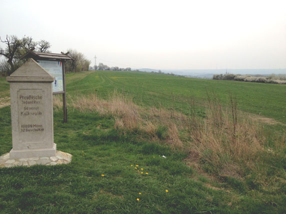
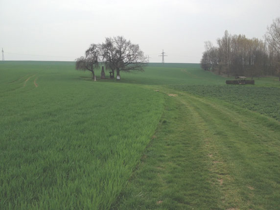
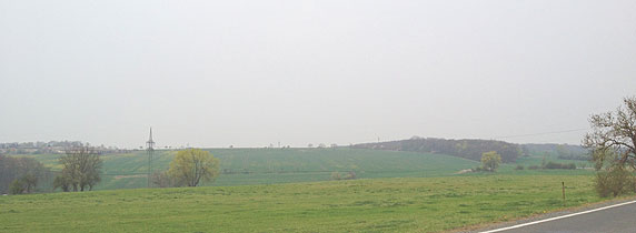
The view looking north from the French position near Cospeda.
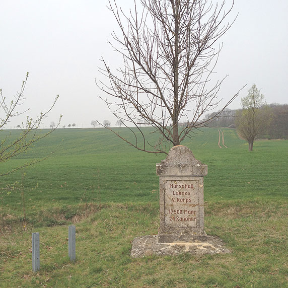
Marker for Marshal Lannes' position near Cospeda.
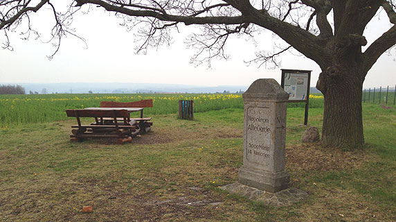
Marker for the Old Guard near the small rise between Closewitz and Krippendorf. I imagine this as the center of the battlefield.
Looking down from the French position toward the village of Krippendorf.
Looking down from the French position toward the village of Krippendorf.
Church steeple in Lutzeroda or Cospeda.
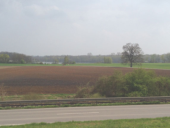
This is one of the least famous big battles of the Napoleonic wars, so maybe its not surprising there arent many battlefield markers or indications of what took place here. The most important landmark is the restaurant dedicated to Napoleon (Napoleon Gaststatte) in Eggmuhls largest building. On the walls are paintings of the battles aftermath, when the Austrians had been defeated and Davout and Napoleon met in Eckmuhl. Nearby are the little towns of Unterlaichling and Oberlaichling. Apparently much of the fighting took place in the woods and fields around this small area, though the maps of the battlefield portray a much larger zone of combat. All of the towns are pretty and photogenic, and I enjoyed the drive around the area, but I admit I didnt have much idea of the relative positions of the armies other than the general direction of French advance and Austrian retreat towards Eckmuhl and then up the road towards Regensburg. Of course, Regensburg and its famous bridge are well worth a visit, since these were the real objectives of the battle.
The flat battlefield looking from the road between Unterlaichling and Oberlaichling.
The flat battlefield looking back from near Eckmuhl towards Unterlaichling and Oberlaichling.
In Eckmuhl.
In Eckmuhl.
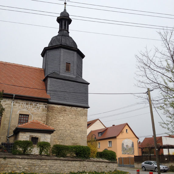
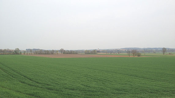
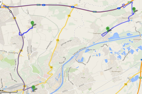
Ulm was one of Napoleons greatest strategic exploits, since it involved cutting off the Austrian forces from the rear by rapid marches, achieving their surrender with little fighting. But there were some major engagements. One is near the abbey of Elchingen, where the battlefield is kept in pristine shape, with a few markers along the roads around the village. The Abbey is at the top of a high hill near the Danube. You can drive across the Danube from Burlafingen to Thalfingen, roughly following the French advance, and then uphill into Oberelchingen where you pass through an ancient single-lane gate into the town. This is another one of those great little battlefields. Less impressive is the area north of Ulm around Jungingen where there was plenty of fighting and maneuvering. The fields and villages are there, but the whole area is bisected by a lot of big avenues and highways with heavy city traffic, and views of nearby truck stops and factories. I suspect I missed out on some battlefield markers here, but didnt feel like stopping.
From the road between Thalfingen and Elchingen there is a large battlefield marker and map. This is the view from the marker towards the Danube where the French crossed.
View of the battle on the heights by the Abbey.
View of the battle on the heights by the Abbey.
View of the battle on the heights by the Abbey.
View looking from highway 10 near Jungingen towards the west. The French and Austrians disputed this area.
Because of the fame of the Duke of Marlborough, his mansion, and his illustrious offspring, Blenheim is definitely famous, even though it wasnt decisive and the War of the Spanish Succession dragged on long afterwards. The battlefield itself is totally unmarked, even though the villages nearby seem unchanged from their map positions in 1704, albeit with the addition of some solar fields and a highway bisecting the plain. The center of the battlefield (near Oberglauheim, 1 km from the highway) was my first target, and there are lots of dirt roads crossing the fields where Churchills troops held their ground against the French cavalry. The small streams that cross the plain and played a role in the battle are likely unchanged. All the villages are picturesque and tiny, with obligatory church steeples, barns and houses. I found driving around the village of Blindheim entirely uninterestingthere were no packed ranks of trapped French troops poking their heads out of windows, as far as I could see. I spent over an hour circling the different roads around the battlefield looking for an ideal vantage. The best spot seemed to be a family restaurant called Goldbergalm Ausflugsgaststatte located near Lutzingen. But the hill is hardly directly overlooking the battlefield, and Blindheim is only just visible in the distance. Only on a very clear day would this be a perfect view.
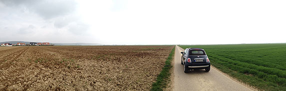
Parking in the fields by Oberglauheim.
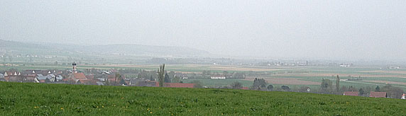
The view from Goldbergalm, with Lutzingen in the foreground and Oberglauheim behind. On the horizon at right is Blindheim, lost in haze.
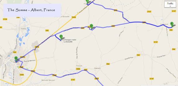
There is a lot to see in the area of the Battle of the Somme, and things are pretty well marked on the highways around Albert, though there are few maps of where the lines were located. These are best downloaded from online in advance. What surprised me was how huge the battle was in terms of depth of the advance. Though I knew trench warfare was static and the battle was a huge strategic failure, since only a few miles were gained here and there, yet it seems quite far when you are actually there, especially given how many lives were lost taking each foot of ground, and how solid the defenses were.
|